Academic

Neal
Zhang

B.S. Geographic Information Science · Expected May 2028
The Ohio State University, Department of Geography

I work with ArcGIS Pro, QGIS, R and Python, and I'm interested in using geospatial data to understand who can reach essential services — and who can't. Below is a selection of my GIS coursework and a few things I've built on my own.

  • Geospatial data analysis
  • Access to essential services
  • Transportation & healthcare accessibility
  • Environmental resilience
  • Spatial inequality & community vulnerability
  • Remote Sensing · GEOG 5225 · A
  • Cartography & Map Design · GEOG 5200 · A
  • Fundamentals of GIS · GEOG 5210 · A-
  • In progress — Spatial Data Analysis, GIS Programming, C++ Programming

01Remote Sensing · GEOG 5225

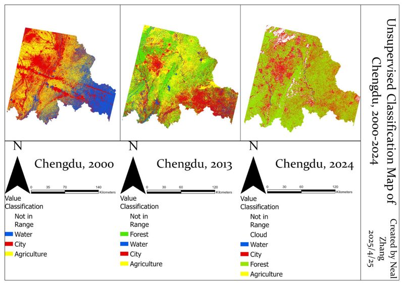
Chengdu — Land-Cover Classification

Unsupervised land-cover classification maps of Chengdu for 2000, 2013 and 2024

Unsupervised classification of Chengdu satellite imagery for 2000, 2013 and 2024 in ArcGIS Pro.

02Raster Analysis · GEOG 5225
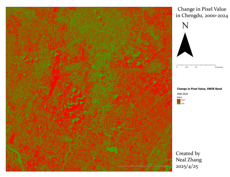
Chengdu — SWIR Pixel-Value Change

Map of SWIR pixel-value change across Chengdu, 2000 to 2024

Band differencing of short-wave infrared pixel values to map surface change, 2000–2024.

03Cartography · GEOG 5200
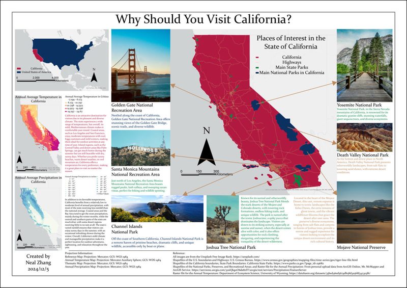
California — Thematic Map Poster

Thematic map poster of California climate, parks and highways

Temperature and precipitation surfaces with highways, national and state parks in a multi-panel layout.

04QGIS · Census TIGER/Line
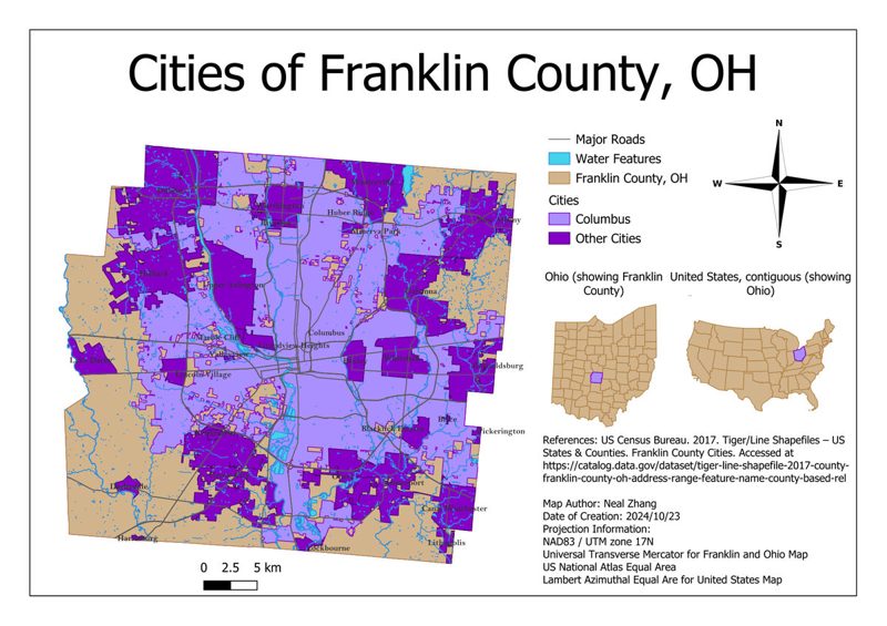
Franklin County — Municipal Map

Reference map of municipalities in Franklin County, Ohio

Municipalities, major roads and water features with Ohio and U.S. locator maps.

Food Trail Map

Web mapping
funstuffneal.com

  • Interactive web map of restaurants visited in Chengdu, built on the Amap JS API 2.0.
  • Password-protected editor for creating, updating and deleting point records.

Real-Time Data Dashboard

Independent project
Node.js · WebSocket

  • Node.js/Express dashboard that streams live data from public APIs over WebSocket and flags rapid changes.
  • Migrated to an alternative data API, including GBK text decoding, after the original source blocked overseas requests.

nealzhang.com

Self-hosted infrastructure
nealzhang.com

  • This site, a blog and a photo gallery on a self-managed Linux VPS — nginx, PM2, Let's Encrypt SSL, Cloudflare DNS and R2 storage.
  • GIS — ArcGIS Pro, QGIS, unsupervised classification, raster differencing, thematic mapping
  • Data — R, Python, C++; descriptive statistics; sampling design
  • Web — JavaScript, Node.js/Express, HTML/CSS, Amap JS API, nginx
  • Languages — Mandarin (native), English (fluent), Japanese (studying)
  • Dean's List — The Ohio State University, Autumn 2024 & Spring 2025
  • Second Prize, NOIP — National Olympiad in Informatics in Provinces, Junior Division, Sichuan (C++), 2017